Habitat models
 Swedish

Contents
Applications: PlanVis och RegVis
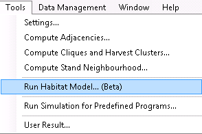
The function "Run Habitat Model" calculates the area of suitable habitat in a landscape for a number of selected species. These species are
| • | Siberian jay (Perisorues infaustus, sw. Lavskrika) |
| • | Hazel grouse (Bonasia bonasia, sw. Järpe) |
| • | Lesser woodpecker (Dendrocopus minor, sw. Mindre hackspett) |
| • | Harminius undulatus (sw. Violettbandad knäppare) |
| • | Witch’s hair lichen (Alectoria sarmentosa, sw. Garnlav) |
| • | Red squirrel (Sciuris vulgaris, sw. Ekorre). |
The species have been selected as indicator species for different ecological niches (see Framework for building models for species habitat suitability...). Altogether, they provide a picture of the suitability of a landscape for different types of species.
It will eventually also be possible to add your own, user-defined models.
Vector vs. raster-based models
PlanWise includes a tool for creating a neighborhood around each stand polygon in terms of a circle with center at the polygon centroid. The program calculates which other polygons that intersect the circle and how large part each of those polygon that are overlapped by the circle. The results from this function can be used directly in an optimization model. This paper describes an example: Optimizing spatial habitat suitability and timber. This kind of model is here referred to as vector-based. At the time a vector-based model can currently only be used in the optimization tool in PlanWise and you cannot save the results to the result database. You can only get the results from the output displayed after solving a problem in the status window. In future versions the vector-based model will also be available to make it possible to check and save the results obtained in an optimization.
The other type of model is using raster-based analysis. It cannot be used as part of an optimization model but can only be run for an existing optimization result created in PlanWise or for a simulation result in RegWise. A raster-based model operates by converting the stand polygons to a raster grid. For each cell in the grid a certain neighborhood is evaluated, in addition to the forest state in the cell itself, to determine whether the cell can be qualified as suitable habitat. This means that the spatial resolution is higher in a raster-based model, compared to a vector-based where each polygon is evaluated as one (and only one) object. A raster-based model can for example take into account that parts of a stand can be subject to edge effects.
About the models
Here is the theory behind the models described.
Edenius, L & Mikusinski, G. 2012. Framework for building models for species habitat suitability
assessment in the biodiversity module of Heureka system. PM. with references. Heureka_Habitat_models.pdf
Here is a report on how model settings may affect the results:
Norman, L. 2015. Sensitivity analysis of the habitat models used in the Heureka planning system. Master thesis. https://stud.epsilon.slu.se/7600/7/norman_l_150205.pdf