Webmaps and background layers
 Swedish

Contents
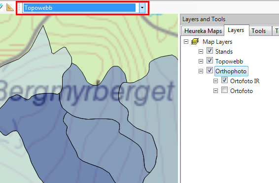
Background images can either be added as a map layer from a raster map image file (for example a GeoTIFF) manually, or by connection to a WMS or WMTS map service.
From version 2.6 you can add background layers by connecting to a WMS or WMTS map server. There is a list of predefined services and you also create a custom connection.
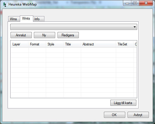
How to create a custom connectionTo create a custom connection, choose Other layer... in the drop-down list above. Then the following dialog is displayed:
|
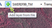
You can also import a raster image from disk. Click the button "Add layer from file" and a dialog will open that lets you select both shape files and certain types of georeferenced raster images (like GeoTIFF).
|